Report Road Effect Zones and Ecological Values of Inventoried Roadless Areas
A Geospatial Analysis Road Effect Zones and Ecological Values of Inventoried Roadless Areas
Inventoried Roadless Areas (IRAs) designated under the US Forest Service’s 2001 Roadless Area Conservation Rule (Roadless Rule) currently encompass 44.7 million acres of National Forest System lands across 2,296 individual areas in 37 states and Puerto Rico. While termed “roadless,”, some IRAs do contain roads, largely as a result of the gap between when the inventories occurred and the Roadless Rule’s effective date. When the Forest Service promulgated the Rule in 2001, it estimated there to be roughly 2.8 million acres of “roaded roadless” areas, but neither the agency’s methodology for determining this acreage figure, nor the geographic locations of those places, documented in the project record.
In August 2026, the US Department of Agriculture – which oversees the Forest Service – released a proposal to completely rescind the Roadless Rule, along with an associated Draft Environmental Impact Statement that analyzes the ecological, social, and economic consequences of the proposal to repeal the rule and two alternative courses of action. One of the Department’s alternatives considers modifying IRA boundaries by removing “roaded roadless” areas from the Rule, which it defines as anywhere within an IRA that is 0.5 miles of either side of existing roads— a distance it applies to both interstate highways and primitive dirt roads. That analysis resulted in the identification of 11 million acres of “roaded roadless,” nearly four times more than the 2.8 million the agency stated to exist in 2001.
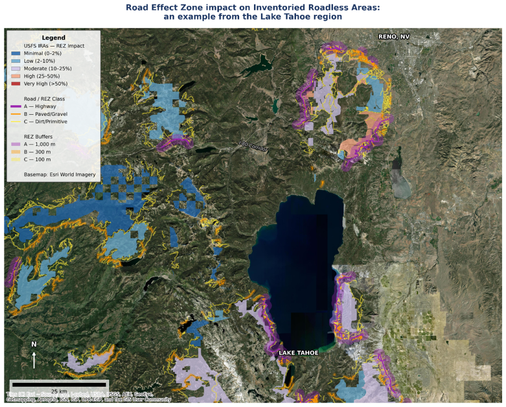
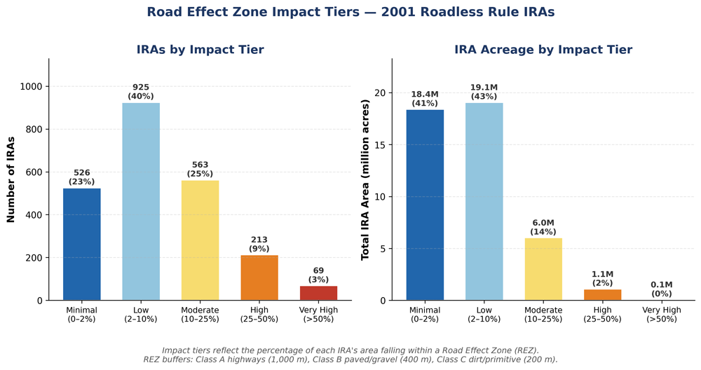
Give the salience of the “roaded roadless” issue to ongoing policy conversations over IRA management, the lack of an adequate project record from 2001, and the significant discrepancy in acreage between the agency’s 2001 and 2026 analyses, we demonstrate here an alternative and scientifically grounded framework for analyzing the possible extent of roaded roadless areas by applying the concept of the Road Effect Zone (REZ), which is the area over which the ecological effects of a road and its traffic extend into the adjacent landscape. Using available data, we assembled 204,343 road segments totaling 107,032 miles that occur within one mile of IRA boundaries, and classified each segment into a three-tier framework based on the likely extent of the REZ from each, as calibrated to the road ecology literature. Our analysis suggests there are approximately 2.4 million acres of IRAs within the REZ. About 50 percent of this area comes from roads within IRA boundaries while the other 50 percent originates from roads outside IRA boundaries, primarily from higher-volume highways and roads.
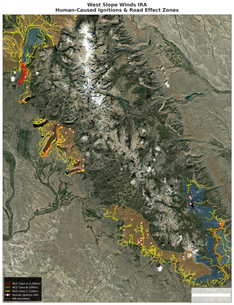
Overlaying those effect zones on national datasets for imperiled species, drinking water source watersheds, and wildfire ignitions makes it possible to explicitly spatially assess where roads and their ecological reach intersect the values and characteristics that the Roadless Rule was intended to conserve. The result is a transparent, reproducible approach that federal agencies, Tribes, states, and agency partners can apply, critique, and refine, along with field verification of actual impacts, when considering possible modifications to IRA boundary.